Toga Valley is an area that cuts through the southwestern mountains of modern day Toyama prefecture.
The whole region of Toyama is known as Gokayama 五箇山, which was named from the region being divided into five valleys coming down from the mountains. The five valleys are Akao Valley 赤尾谷, Kaminashi Valley 上梨谷, Shimonashi Valley 下梨谷, Otani Valley 小谷, and Toga Valley 利賀谷. I talked about the history of Shimonashi Valley little bit in the post about Hosoo Pass.
Four of the five valleys follow the Sho River, which comes from the east side of Mt. Haku going directly north into the Sea of Japan. Toga Valley is different because it follows two different rivers. The Toga River comes from further east to join the Sho River at the base of the mountain. It also follows Momose River, which is further east and never joins either. As such, Toga Valley is almost completely cut out from the other four valleys and is far less populous.

When the river's edge meets the land, the forests begin. The whole area is over 95% deep forest. But, dotted along the cliffsides were several pocketed settlements back in the day with larger clusters up the mountain forming small villages of Toga, Sakagami, and Momosegawa. In 1896, the gun-district system was established which classified the entire Toga Valley as a single municipality, Higashi Tonami-gun Toga Village 東礪波郡利賀村. The entirety of Toga Village covered 176 square km.
As its peak in 1947, the overall population of Toga Village was 4663. (1) Today, it's around 400. It suffered the fastest rate of population decrease in Toyama prefecture in 2010 (-23% in 5 years), and it is one of the most depopulated areas in Japan. Because of that, there are a lot of abandoned buildings, including entire areas which no longer exist today. Last year (summer 2025), I visited the area 4 times because I was interested in the area's old schools.
The first school built in Toga Village was Shimo-Toga Public School 下利賀尋常小学校 in 1892. This was 6 years after the Japanese government's executive order of primary education in Japan 小学校令, which ultimately stated that all children were required to attend and graduate 4 years of elementary school. With Toga Village established in 1896, the school was renamed to Toga Public School 利賀尋常小学校.
Toga's biggest problem was distance. Toga village began where the Toga River 利賀川 branched from Sho River 庄川. Toga River travels over 40km up the mountain to Mizunashi Dam, which forms a lake 水無ダム湖. But, Toga Village also included around 10km along Sho River and the 20km stretch of the Momose River 百瀬川 in the east to its source.
Every 2-5 kilometers along the rivers was a small settlement. 2km doesn't seem all that far today, but in 1900, there were no paved roads or cars. (Cars only debuted in Japan in 1898!) People in the mountains traveled by foot (or rarely by horse). It was impossible for young students in the distant settlements to make the daily trip to school. This trip was even more impossible in winter when snow falls and blizzards cut off settlements completely from each other. (Not to mention the dangers of wildlife and insect attacks.)

To solve the distance education problem, branch schools 分校 were established. These were schools that branched from the main schools to treat students who lived in areas too far or too inconvenient away. They still operated under the jurisdiction of the main school but had their own branch principal and another teacher or two depending on how many students they had. Teachers couldn't be expected to make the daily trip to school either, so they lived in the school in their own living quarters.
In 1902, the first branch schools were established in Tochihara 栃原分校, Kitabara 北原分校, Sennohara 仙野原分校, and Takanuma 高沼分校. These were all areas near the base of the mountain. It wasn't for another 30 to 35 years before more branch schools would open to treat students who lived on the top of the mountain with Mizunashi 水無分校 and Okutaikanba 大勘場分校 branch schools, and another 6 winter branch schools would open for students who lived in between. I don't have all the data, so I think other branch schools opened in this time, too.
Ultimately, these were some of the most reglected areas in Japan for education. They didn't get money to build enough schools to reach all children. Most teachers also considered being stationed in these branch schools as punishment, too, because they'd be completely cut off from their own families.

After World War II, education was restructured. All students were now required to attend 9 years of school. There was 6 years of elementary and 3 years of junior high schools. As the country rebuilt itself, it identified these remote schools as a problem and implemented the Remote Area Education Promotion Act (へき地教育振興法). More branch schools would be built in remote areas to obtain a near 100% attendance rate for schools. And, each remote branch school would now be given a grade (へき地等級). The Remote Grade ranged from 1 to 5 and is determined based on the distance from transportation, hospitals, post offices, and grocery stores. It's also determined by the distance from the main school, city center, and board of education. When a teacher is posted at a branch school, their salary would be increased based on the Remote Grade of the school.
From the educational restructuring in 1947, Toga Junior High School 利賀中学校 would open in the heart of Toga Village. The graduating class was only 17 students. In 1948, branch schools for the junior high opened in Sakagami 坂上分校 and Momosegawa 百瀬川分校. The graduating class grew to 51 students. In 1949, more branch schools opened in Okutaikanba 奥大勘場分校, Takanuma 高沼分校, and Shogawa 庄川分校. The graduating class was now 92 students. Each of these junior high branch schools just used the existing branch schools, which were still used for elementary school students.
Population in Japan soured in the 1950s from 83.4 million people in 1950 and 93.2 million in 1960 (2). However, Toyama Prefecture remained mostly stagnant going from 1 million people in 1950 to 1.03 million in 1960 (3). And Toga Village had began its sharp decline from 4,663 in 1947 to 3,562 in 1950 to 3,038 in 1960 (1).
Throughout the decade, more branch schools would open to cater to those who couldn't make the journey in winter. By 1959, the number of schools in Toga Village was at its peak. There were 21 total elementary schools (1 main school, 11 branch schools, 9 winter schools) (4), and the 6 junior highs (1 main, 5 branch). Note: Through Internet researching, I could only find 17 elementary schools.

In 1962, the dormatory at Toga Junior High School was completed. All distant students now lived at school, which closed all junior high services for branch schools. More and more branch schools continued to close throughout the 60s as infrastructure was built. Roads were paved connecting all the settlements and more people owned cars so they could travel easily. They could also plow snow in winter easier which closed a significant amount of winter branch schools.
Throughout history, the people in Toga have been pretty poor. The mountains were terrible for growing rice, so most people lived off of growing beans and buying food from selling silk and gunpowder. With the country booming, many families abandoned their old homes to move into cities where they could find decent work and make a much better living. This also closed many branch schools as their neighborhoods were vacated.
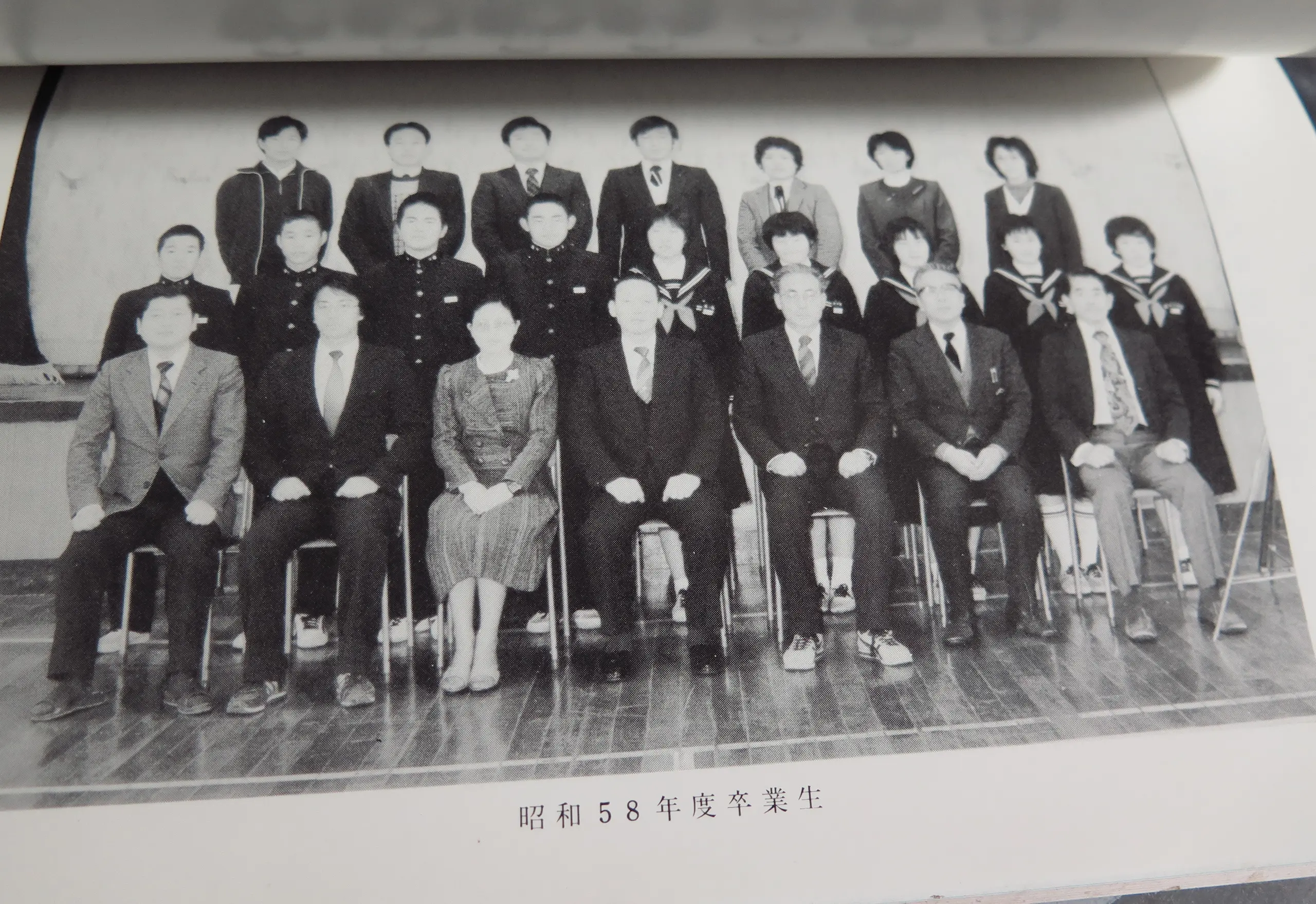
This continued into the 70s. Tunnels were built between the mountains connecting each of the valleys, and expanded motorways were built, too, to make daily travel very easy. In 1970, the population of Toga Village shrank to 1,961, and by 1980, it was 1,328 (1). In 1983, the graduating class of Toga Junior High School was only 9 students, the lowest to date. (There were 17 students in the class of 1984, though.)
By the 1990s, most of the branch schools had either closed or left dormant. In 1996, all remaining branch schools were officially closed and the government sold the buildings to whoever wanted them.

In 1998, the above school was built, the Toga All Persons School 利賀アーパス. This huge building combined both Toga Elementary and Junior High together in a single building. There was also space for community classes, and had room for foreign students to study abroad from their sister city in Greece. Population of Toga was around 1,000 at this point and all students took the bus to school. Some students had an hour commute.
In 2004, there were municiple mergers across Japan and Toga Village folded into Nanto City which now covered all of Gokayama and the towns and cities creeping into the urban area of Takaoka. Population was 855 at this point. By 2015, there were only 18 total junior high students, and 16 elementary school students.
In 2024, both elementary and junior high schools combined into a single school called Nanto City Toga School 南砺市立利賀学舎. At the time, there were only 10 junior high students (among 3 grades) and 13 elementary students (among 6 grades). The graduating class was only 2 students. There was only one 6th grader and zero 2nd graders. (5 6)
Only 400 people live in Toga today and they're mostly elderly people. Not many young people live out here and there's really no reason. There's lots of construction, but those companies set up temporary housing for their workers in summer. Very few of those workers actually live in Toga. Historically, the area has been poor so there's not much value in living here.
Here's a full timeline of these events: /toga-valley-timeline
Again, Toga Valley begins where the Sho River 庄川 and Toga River 利賀川 join at the base of the mountain. Toga Village contains the first 10km along the Sho River, but the majority of the village follows Toga River up the mountain to Mizunashi Dam Lake 水無ダム湖. There's also the initial 20km stretch of Momose River 百瀬川 in the east that runs mostly parallel with the Toga River.
In 2025, I went to the area 4 times and visited 14 of the old schools and settlements of Toga Valley. Let's look at each of the areas of Toga Valley in order from the base of the moutain.
Shogawa is the first area at the base of the mountain, and its the first cluster of homes visited after leaving the flat lands of Nanto and Tonami. There was a branch school in this neighborhood, but it no longer exists today, and I can't seem to find any traces of it. I'm not sure when it was initially built, but it was probably in the 30s. It was used for Toga Junior High School from 1949 to 1962, and there's photo of it in the Anniversary book. (Also in 1952, the 4 villages north of Toga Village were collected together to form Shogawa Town, which isn't the same and makes searching more annoying.)

There are still several homes and businesses in Shogawa today including the Komaki Dam. 1.5km up river from Komaki Dam is where Sho River and Toga River join. From Komaki Dam, if you're on the west bank, you'll continue up the Sho River. If you're on the east bank, you'll follow Toga River.
Following Sho River, the first major neighborhood is Shimoboara. Shimobara's branch school first opened in 1935 as 利賀小学校栃原分校下原冬季分校, or Toga Elementary Tochihara Branch School Shimobara Winter Branch School. It was a branch school of another branch school. Later in 1976 when Tochihara Branch School was closed, it become a full branch school as 利賀小学校下原分校. It closed in 1986. It was a Grade 2 remote school.

People still live in Shimobara today, although there are only 4 or 5 houses. The branch school used to be in the center, but it was demolished in the last 2 years because of asbestos.
Article and Photos: /shimobara-winter-branch-school
Directly south of Shimobara is Tochihara, which was the central area because of the space. Tochihara had open areas along the valley which was perfect for farming. Tochihara Branch School 栃原分校 was one of the first branch schools, built in 1902. Most people moved away by 1973, and the area became uninhabited in 1976, although the farms still remained and there was now a Ski resort, too. The branch school was officially closed the same year. (7)
A few kilometers further down Sho River were the final settlements before Taira Village. Shigekura probably shouldn't even be mentioned as it was only one household and the people moved away in 1906 (8). Arayama had 5 households at its peak in 1889. In 1934, an avalance killed all 5 men living there. Two of the families moved away, and eventually in 1955, the remaining households were abandoned. (9)
There's one more area on Sho River and that's on the opposite side of the river from Shimobara and Tochihara. These days, it is known as Kitahara, but it's original name was Kitabara. There was enough room along the cliffs of the east bank for farms, so naturally another settlement was formed. Kitabara Branch School 利賀小学校北原分校 was one of the first to open in 1902 and it continued to be used through 1971. It was completely closed in 1986 with Shimobara. It was also a Grade 2 remote school.
Today, there are some houses still there and several inns. The branch school has long been demolished. Apparently it was located near the inn called Toga Guest House 利賀之家 (10). I might try to spend a night there in the future, as its only 7500円. :)

Today, there is a huge bueatiful bridge connecting Kitahara to the west bank. It's part of a tunnel construction project which is still in progress. When complete, the tunnel will go straight through the mountain to Toga Village's center.
Article and Photos: /kitahara-and-tochihara
Going from Shogawa on the east side of Komaki Dam, the path will follow the east bank of Sho River, and then follow Toga River. Up the cliff a little bit, you'll find a fork in the road. This small path will travel down to the river's edge and use a bridge to cross. On this slim area of land on the opposite side of the mountain of Kitabara is Sennohara. 9 households were here, so the Sennohara Branch School 仙野原分校 was built in 1902. It was also a Grade 2 remote school. However, by 1966, the area became abandoned. (11)
In 1935, the branch school was demoted to only a winter branch school of Kitabara's branch school 利賀小学校北原分校の仙野原冬季分校. Today, the only thing of note in the area is the Jizo Statue Hall on the side of the road marking the entrance path.

Further up the main path about 1.5km toward Toga Village center were the tiny settlements of Kurito and Wakidani, which Murakami considers as the same village. (12 13) Today, there are a few houses next to the road which are empty, but I didn't not take a look.
Back in the day, there was Kurito Winter Branch School 利賀小学校高沼分校栗当冬季分校, which was part of Takanuma's Branch School. It opened in 1934 and closed in 1967 as Grade 2 remote school. Kurito became uninhabited in 1979.
Continuing along the main route another 2.5km, we reach the first significant neighborhood, Takanuma. It's branch school opened in 1902 along with the other 3 branch schools in Sennohara, Kitabara, and Tochihara. Takanuma Branch School 利賀小学校高沼分校 continued to operate through 1978 and was officially closed in 1996. (Grade 2 remote)

The original building is long gone, but the concrete branch school built in the 60s is still there. I was able to go inside and take many photos. It seemed like people who still lived in the area used it as a community building but that was decades ago. Around 2016, the last resident of Takanuma moved away (or died). In Google Street View history, you can see some of the homes that have now been demolished.
Article and Photos: /takanuma-branch-school
Continuing another 3km towards Toga Village is the now abandoned settlement of Sorei. Sorei became abandoned some time in the late 1990s. At its height, there were 17 households with 135 residents in 1947. (14) Today, it is completely overgrown, but there are some signs that people have tried to protect the area's shrine.

The Sorei Winter Branch School of Takanuma Branch School 利賀小学校高沼分校草嶺冬季分校 was built in 1935 and was closed in 1977. It's remaining students then went to Takanuma Branch School before that was closed a year later.
Article and Photos: /abandoned-sorei-settlement
Moving up another 3km is the Oshiba settlement, which seemed to follow a similar history as Sorei. At its peak in 1947, there were 10 households with 93 residents, each of which steadily moved away eventually leaving the area abandoned in the late 1990s. (15)

Today, the area has been bulldozed by a construction company. The Shinmei Shrine is the only thing that remains of the original village. The Oshiba Winter Branch School 利賀小学校北豆谷分校押場冬季分校 opened in 1930 and closed in 1968. It was a Grade 2 remote school, and it was a winter branch of our next school, Kitamamedani.
Article and Photos: /abandoned-oshiba-settlement
Only a kilometer away is the neighborhood of Kitamamedani which is still populated today. It's also the first area we've reached that has an active Post Office branch. There are over a dozen homes, and when I visited, some people were outside working on a project.
I could not find any information about when the Kitamamedani Branch School 利賀小学校北豆谷分校 opened, but I could find that it closed in 1968 along with Oshiba Winter Branch School. I'm sure the area still had students at this time. I think the reason it closed was because the center of Toga Village was only another 2.5km away and the main road was probably safe enough to bus children to school each day. I think this was a Grade 1 remote school given its closeness to the main school.

It's the most striking of schools I had visited yet with its space age spherical windows in its main staircase, and attached gymnasium. After the school closed, it was still used for the neighborhood's yearly Sports festival. The gymnasium was remodeled as a community hall with a full tatami mat floor. Looking inside, it looked like it was being regularly used through 2003. That was one year before the municipal mergers, so maybe their community banquets moved to Toga Village center.
Article and Photos: /kitamamedani-branch-school
We have now traveled 17km from Komaki Dam to the center of Toga Village. Most of the people who still live in Toga Valley live here and in Sakagami further up the road. There is one governmental building in the middle of town which is the Nanto City Toga Village Branch Office. Inside are the city offices, the post office, and the bank. The building also doubles as a Road Side Stop 道の駅, so there's also a store and restaurant.

Up the hill is the turn off for Toga School. As mentioned before, this was built in 1998 as Toga All Person's School 利賀アーパス which housed both Toga Elementary and Junior High School. In 2024, both schools combined into a single school simply called Toga School 利賀学舎. In 2024, there were only 10 junior high and 13 elementary students for this huge building. It's a difficult trek up the hill, so all students take the bus to school.
After World War II and the enactment of the new educational orders, Toga Junior High School 利賀中学校 became the pride of Toga Valley. It's original location was not here, but 500 meters south of the branch office. It was opened in 1947 and remodeled in 1962 with a full dormatory. From 1962, nearly all junior high students lived at school (especially in winter) in order to completely centralize secondary education. Over the years, as more and more roads were built only the most distant students had to live at school. By the 1980s, I don't think the dorms were used. There were only 9 graduates in 1983, anyways. (16)
Looking through Google Maps, it seems like the building was demolished between 2018 and 2021.
When Toga Junior High was rebuilt in 1962, construction for a new Toga Elementary was already underway. Toga Elementary's concrete building was completely in 1963, and this building still stands today. According to Google, it's been used as Toga Dam's office building.

I'm not sure if this was the original site of Toga Public School back in 1892. I don't have any photos of the original wooden building. The concrete building, though, is located between the branch office and the site of the old junior high. It sits next to several homes.
Toga Elementary was not Toga Valley's only full-fledged elementary school. The neighborhood of Sakagami which was 4 to 5 kilometers up Toga River had just as many homes. Sakagami neighborhood was also very flat, so it provided lots of space for farming.
I'm not sure when the first branch school opened in Sakagami, but it was probably back in the 20s or 30s. With the new elementary and junior high buildings built in the center of town in the early 60s, the Sakagami Branch School was upgraded to a full elementary school in 1968 with a new building. This was Sakagami Elementary School 坂上小学校.

Splitting Toga Elementary was probably a good idea because there were so many branch schools and winter branch schools. Now, all of the southern branch schools (the ones further up the mountain from here) in Toga could operate from Sakagami Elementary. The grduating class of Toga JHS in 1964 was 79 students, so each class in Sakagami ES probably had around 30 students each. (17) Sakagami Elementary was later closed in 1996 along with all branch schools that hadn't been closed already.
Today, the Sakagami Elementary School building is Star Forest スターフォレスト利賀. Star Forest is a "guest home" that families and schools can rent. Occupants can use the gym, baths, and kitchens as a service. I went there in June, and there were several families in the building. They were packing up a bunch of mountaineering equipment into a truck getting ready to leave. The website says they aren't taking reservations, so maybe its only open in summer?
Prior to Sakagami Elementary, students in the Sakagami neighborhood were taught in the Sakagami Branch School 坂上分校. The branch school is 1km further up Toga River from Sakagami Elementary.

Again, I'm not sure when it opened. It was probably in the 20s or 30s. It was used by both elementary and junior high school students until 1962 when the junior high dorm was built. It was closed in 1968 when Sakagami Elementary School opened down the road.
I went inside the building and looked around. Apparently it was used as a textile sweetshop for women's undergarments in the 70s and 80s. The most recent item I found inside was a calendar from 1996.
Article and Photos: /sakagami-branch-school
We move past normal signs of civilization another 3km up Toga River to the old settlement of Tanoshima. Tanoshima Winter Branch School 利賀小学校大勘場分校田ノ島冬季分校 opened in 1935 as a branch school of Okutaikanba. By 1960, it was used by 16 students. (18) This was a Grade 3 remote school.
The branch school closed in 1965 when the roads were good enough for students to attend Okutaikanba all year round. By 1978, the final resident moved away leaving the area vacant, although one of the buildings was still as project space for a junior college.

Today, the only original building that remains is the Shinmei shrine. Sometime between 2019 and 2021, all buildings were removed and a French restaurant called Levo was built. Levo acts as both a restaurant and a lodge, but prices are 31000円 per person at the restaurant. I have no idea who this restaurant is for. Looking from the outside, it reminds me of the restaurant from The Menu.
Article and Photos: /tanoshima-shinmei-shrine
Moving 1km up Toga River brings us to the small settlement of Nakaguchi. Nagaguchi Winter Branch School 中口冬季分校 was opened here in 1953, and closed in 1965 with the Tanoshima school. It was a Grade 3 remote school. Apparently the school operated out of one of the resident's homes. (19)
Heyaneko visited there in 2010 and there was still a house with someone working on the roof. Although, the area became officially uninhabited in 1992. Looking at Google Maps, that home is no longer there. It was demolished (or collapsed) sometime between 2019 and 2021.
Moving another 1km up Toga River is the neighborhood of Okutaikanba, which has several homes and Senzoku Dam. After Sakagami, this was the most central area of the southern settlements, so they built a full branch schoool here, Okutaikanba Branch School 奥大勘場分校 in 1935. In 1949, classes were established for junior high school students, too, and by 1959, there were 54 students. This was a Grade 3 remote school.
In 1976, the name was changed to Senzoku Branch School 千束分校, which matched the name of the Dam. By 1984, the school was no longer used and it was officially closed in 1996.

Sometimes between 2021 and 2023, the building was demolished. Someone lived in the building in the 2000s, but then a construction company (or the dam offices) used it for housing. It was probably demolished because all these buildings were full of asbestos.
Article and Photos: /senzoku-branch-school
Continuing up the Toga River past the Toga No. 2 Power Plant was another cluster of homes at 1.5km. This was Katsurao neighborhood.

Katsurao Winter Branch School 利賀小学校大勘場分校桂尾冬季分校 was established here in 1944. Much like Nakaguchi's branch school, I think it just operated out of someone's house. It was a Grade 3 remote school, so they got paid well. It was closed in 1965. By 1975, the neighborhood still had 3 homes with 7 residents. (4) But today, there is no one. Two buildings still stand, but probably not for long.
Nearly at the source of the Toga River, another 2km upstream brings us to Taikanba. Finding the history of this school is difficult because its name 大勘場 is nearly the same as Okutaikanba 奥大勘場. I think some of the histories were mixed up.
Wikipedia says that Katsuaro Winter Branch School was a branch of Taikanba not Okutaikanba, so I think the Taikanba was out here in the 30s and 40s. Wikipedia also says the name Taikanba Branch School 大勘場分校 was officially established in 1976 when Okutaikanba changed its name to Senzoku. So, that's inconsistent. It was closed in 1996. The area became uninhabited around 2012.
This was a Grade 4 branch school, the highest grade yet. It's about 12.5km from Toga Elementary and nearly 30km from Komaki Dam.

The Taikanba Branch School building is still here today and it still has power. I arrived around Noon o'clock and the Noon Chime began to play from the loudspeakers attached to the building, which freaked me out at first. The road behind the school leads into the old village, but all of the homes have now collapsed. Looking through Google, the last two homes only recently collapsed in the last 5 years.
Article and Photos: /taikanba-branch-school
500 meters past Taikanba, the road is closed. This is essentially the end, however, further past the closed gate, the road continues for another 10km to Mizunashi Dam 水無ダム, which is the source of Toga River. The whole area of mountain and forest is known as Mizunashi, and it also had a small settlement, which was another 5km going east from the lake.
Mizunashi Branch School 水無分校 opened in 1929. It began in someone's house until its own building was constructed. It was used until 1966 and closed in 1967. By 1970, all residents of Mizunashi had moved away. (4)
Mizunashi was designated as a Grade 5 remote school, the highest grade, and its easy to see why. It was nearly 30km further up the mountain from Toga Village center, and Toga Village was already 17km into the mountain from normal civilization. Even today, it would take nearly an hour to drive from Mizunashi to Toga Village. Now, it can only be accessed from Hida on the other side of the mountain.
From the base of the mountain at Komaki Dam and traveling over 40km all the way to Mizunashi Dam Lake, there were 14 settlements and villages, each with their own schools.
Sennohara → Kurito / Wakidani → Takanuma → Sorei → Oshiba → Kitamamedani → Toga → Sakagami → Nakaguchi → Okutaikanba / Senzoku → Tanoshima → Katsurao → Taikanba → Mizunashi
Strings of villages through mountain valleys make sense when there's an eventually destination, like a large city on the other side of the mountain, but Toga Valley doesn't go anywhere. It's final destination is an artificial lake. The whole valley had poor soil and growing conditions, so the people living up here were always poor and occasionally starved to death in winter.
Maybe this was just a good area to get away from everyone. There were never any daily travelers (other than their neighbors), so people were able to live by themselves.
Toga Valley was more than just Toga River (and the little bit on Sho River). Running parallel to Toga River to the east about 1.5 away was Momose River 百瀬川. Momose River began on the west side of Mt. Kongodou 金剛堂山 and continues around 20km until Yamada Dam, which is near Takanuma. The areas of Momose River didn't have as many people as Toga River, but the area was much flatter providing much better farmland, especially for rice.
Let's start with the neighborhood of Momosegawa. It's the central neighborhood of Momose River and it's directly east of Toga Village about 1km over the mountain. There was a path through the mountains for farmers to travel and sell their crops.
Momosegawa Branch School 百瀬川分校 opened sometime in the 20s and 30s. I don't know for sure. It was originally a large wooden building on the east bank of the river.

Today, this is all that's left of the original wooden building. Looking through Google Maps, every few recent years, it seemed like more and more of the building was removed, and now it's just this house with the side of it covered with a tarp.
In 1971, the school was upgraded to a concrete building, which was built closer to people's homes. It was used through 1989, then officially closed in 1996. Both old school buildings were used for Sake brewing after their decommission.

I visited Momosegawa Branch School on June 7th. The door was open, so I could go inside and take many photos. I returned two weeks later and it was now fenced in and scheduled for demolition. Construction crews santized and tore it down over the summer.
When I returned in September, the building was gone.

Momosegawa was one of the tentpole branch schools of Toga Valley alongside Takanuma, Okutaikanba, Sakagami, and Shogawa.
Article and Photos: /momosegawa-branch-school
Moving north down the river about 3.5km is where Suganuma neighborhood used to be. In 1955, construction on the Suganuma Dam 菅沼ダム began and on its completion in 1958, all homes and lands became submerged and destroyed from the new lake. I could not find any information about there being a school here, but there were 4 households that were now under the lake. (18)
There is a monument to the village around the area somewhere according to Murakami. I'll try to find it next time I'm in the area.
Going the opposite direction from Momosegawa is Kamimomose, and the final neighborhood of Toga Valley. It's about 4km away up river. I know very little about Kamimomose Branch School 上百瀬分校, other than that it was closed in 1991. After it closed, the nearby construction company used it as their office, and used the gymnasium for storage. Sometime between 2021 and 2023, the building was demolished, but the construction kept the gym as a storage shed.

After visiting Momosegawa Branch School, I went to Kamimomose and took a bunch of photos. I did notice that Kamimomose Branch School was a branch of Sakagami Elementary School and not a branch of the main school. Sakagami is about 2km west of Sakagami over the mountains, so I guess that was more convenient.
Article and Photos: /kamimomose-branch-school
Today, the area of Momosegawa has a lot of camping grounds and recreational areas for retreats. They also have a yearly Photo Rogaining event!
Overall, I find the area of Toga Valley fascinating. Its an area that seems like people have always struggled with money, food, and population. Only the areas of Momosegawa seemed fertile enough for large rice production, but there were so many other small pockets along the valley that continued to survive. Again, I'm not really sure why people lived so far up the mountain when there wasn't anything there.
Most settlements, villages, towns, and cities were built and grew from being on the way to the next big village, town, or city. Or people settled in an area that was abundant in some resource. Maybe the settlers of Toga valley were looking for riches in the mountain, but never found any. Or maybe they just wanted to get away and stay away from the rest of Toyama. Either way, once Japan modernized after World War II, families recognized there was no value and left.
Looking back at the population chart (1), Toga Valley had a steady population of around 3000 until its spike and peak in World War II. That spike (4,663 people) is a little misleading as it wasn't natural population growth. During World War II, large Japanese cities were routinely fire bombed by the US, and Toyama City was the most devastated in Japan. The US even used it as practice for Hiroshima and Nagasaki launching 4 "pumpkin bombs" that destroyed 99% of the city on August 1st, 1945.
Many people moved their families into the mountains to avoid these bombings and this created a population spike in rural Japan. After the war and Japan was rebuilding, there were so many new jobs available in the cities, and neighborhoods were being rebuilt. There was no reason to live in the mountains anymore, and it was probably even sabotage if you stayed.
Even so, the old guard continues to hold their old homes in the mountain valley with seemingly no real hope for the future. Maybe once the tunnel opens it'll bring more people to Toga, and they could focus on more camping and leisure outdoor activities, like mountaineering and river fishing. I don't think Toga will ever fully go away when Toga Valley's nature looks so great.
All of the schools and abandoned villages I visited have been collected into singular posts. They were all linked throughout this post, but they have also been collected at this keyword: keyword/toga. After researching everything, there are a few more new places I want to visit, and double check on a few old ones, so I expect that keyword to grow a little in the future. :)


